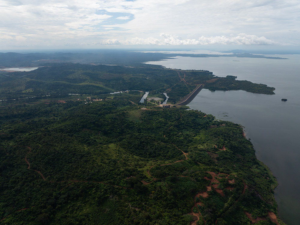
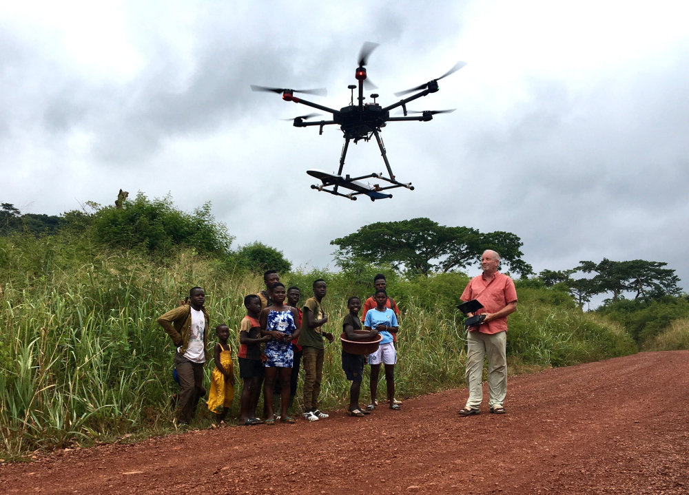
The Kossou Gold Project is located approximately 35 kilometers from Yamoussoukro, the political capital of Côte d'Ivoire, and is only 6 kilometers from a significant and well-established gold operation. This location is a key advantage, as it demonstrates the gold-rich potential of the region and provides access to nearby mining infrastructure.
Projects
Location: Yamoussoukro, Côte d’Ivoire
Stage: Diamond Drilling
Mineral: Gold
Ownership: 100%
Land Package: 110.2 km2
Status: Exploration
Infrastructure: Well-established roads, water, and power access, skilled labour, proximity to processing facility
Land package
The Kossou Gold Project spans over 110.2 km² of highly prospective ground in central Côte d'Ivoire. Exploration permit PR-852 covers highly prospective Birimian terrain, providing Kobo Resources with the opportunity to explore, discover and develop significant gold resources.
Infrastructure
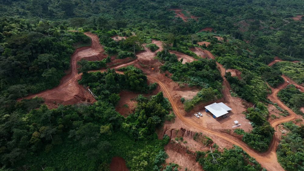
The project benefits from excellent infrastructure, including well-maintained roads, power, and water, as well as proximity to major cities and established processing facilities. This infrastructure is crucial for cost efficient exploration and potential development of future mining operations.
The permit
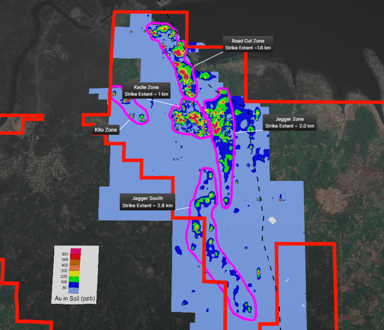
Our flagship asset hosts three key targets—the Jagger Zone, Road Cut Zone, and Kadie Zone—which have demonstrated strong gold mineralization through ongoing exploration efforts.
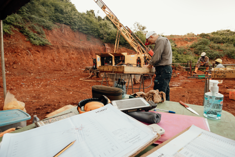
To date, we have outlined over 9 kilometers of robust gold-in-soil geochemical anomalies, supported by 5,400 meters of trenching and 5,900 meters of reverse circulation (RC) drilling completed in 2023. Since initiating diamond drilling in Q4 2024, the Company has completed more than 200 drill holes totaling over 31,000 meters at Kossou. Drilling to date has primarily focused on the Jagger and Road Cut zones, with the Kadie zone emerging as an increasingly compelling target as exploration advances.
The mineralization discovered at Kossou shows high potential for future development, with promising initial trench and drill results that underscore the project's capacity for growth. With excellent infrastructure and an aggressive exploration plan, the Kossou Gold Project is well-positioned to become a major asset for the company as we advance toward defining a significant gold resource.
Early exploration
Geology
The Kossou Gold Project is located in the southern part of the West African Craton, which hosts many significant +1 moz gold deposits and is one of the most prolific gold belts in the world. Orogenic gold deposits are generally associated with brittle-ductile shear/fault systems showing pervasive alteration with disseminated sulphides and discontinuous quartz veins arrays and stock-works hosted within volcanic, sedimentary and intrusive rocks.
Geochemistry
Over 4,930 soil samples and over 925 rock samples have been collected across the Kossou Gold Project. The gold-in-soil geochemical anomalies, defined as greater than 50 ppb Au define our key target areas and have delineated over 9 kms of targeting that is being explored. These targets are supported by rock samples and/or evidence of artisanal mining, highlighting their importance.
Structure study
Gold mineralisation is confined to a well-defined NNW to NS striking fault bounded corridor that is +300 m wide and greater than 3 kilometers in length. Gold-bearing high strain lenses straddle areas of the highest shear strain, pervasive hydrothermal alteration and brittle fracture.
Jagger Zone
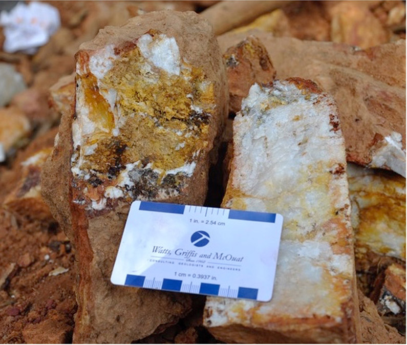
The Jagger Zone is a highly promising gold target, defined by a + 2 kilometers long gold is soil anomaly that contains a series of shear zones over a total width of 100 m. Early exploration was very encouraging, with surface samples showing gold values as high as 45 grams of gold per tonne (g/t Au).
Key trenching results
29.0 m at 6.42 g/t Au (KTR028)
68 m at 1.83 g/t Au (KTR043)
19.0 m at 5.07 g/t Au (KTR030a)
14.0 m at 2.67 g/t Au ( KTR047)
Key RC drlling results
48.0 m at 1.03 g/t Au (KRC009)
19.0 m at 2.03 g/t Au (KRC011)
6.0 m at 4.31 g/t Au (KRC015)
8 m at 2.94 g/t Au (KRC002)
10.0 m at 2.12 g/t Au (KRC010)
Key diamond drlling results
38.2 m at 1.55 g/t Au (KDD0001)
11.0 m at 3.78 g/t Au (KDD0040)
14.0 m at 2.91 g/t Au (KDD0021)
7.0 m at 4.83 g/t Au (KDD0026)
6.0 m at 5.47 g/t Au (KDD0022)
Trenching, RC and DD results have been strong throughout the zone to date and there remains significant potential for additional gold mineralisation both along its length and to depth. This makes the Jagger Zone one of the most exciting targets and it is a focus in our 2024 drilling program.
Road Cut Zone
The Road Cut Zone was the initial discovery at Kossou Gold Project and has returned very strong trench results including 47 m at 3.92 g/t Au. The zone is comprised of multiple northwest trending shear zones traced over a strike extent of +1 kilometers. RC drill results from the 2023 program included 13 m at 2.10 g/t Au and diamond drilling in the first half of 2024 returned 9 m at 4.27 g/t Au.
Key trenching results
47.0 m at 3.92 g/t Au (KTR059)
33.0 m at 4.68 g/t Au (KTR049)
28.0 m at 4.44 g/t Au (KTR070)
22.0 m at 2.76 g/t Au (KTR082)
Key RC drlling results
13.0 m at 2.10 g/t Au (KRC044)
8.0 m at 3.19 g/t Au (KRC022)
12.0 m at 1.49 g/t Au (KRC040)
5.0 m at 3.27 g/t Au (KRC051)
15.0 m at 1.06 g/t Au (KRC039)
Key diamond drlling results
11.0 m at 6.77 g/t Au (KDD0052)
17.0 m at 3.87 g/t Au (KDD0095)
10.0 m at 4.57 g/t Au (KDD0056)
9.0 m at 4.27 g/t Au (KDD0014)
15.5 m at 2.30 g/t Au (KDD0091)
The Road Cut Zone remains open along strike and at depth making this a very prospective target and is priority target for the 2024 drilling program.
Kadie Zone
The Kadie Zone was identified during early exploration and has shown strong potential. Discovered using gold in soil geochemical surveying the zone quickly became of interest. Trench sampling revealed some exciting results, such as 22.0 m at 2.73 g/t Au, including 11.0 m at 5.16 g/t Au and 23.0 meters at 1.77 g/t Au. In 2024, initial diamond drilling produced even more remarkable results, including 9.0 m at 23.89 g/t Au, with one section containing 1.0 m at 210 g/t Au, demonstrating the high-grade potential of the zone.
Key trenching results
22.0 m at 2.73 g/t Au (KTR036)
23.0 m at 1.77 g/t Au (KTR063)
7.0 m at 4.78 g/t Au (KTR065)
16.0 m at 1.89 g/t Au (KTR064)
10.0 m at 2.27 g/t Au (KTR038)
Key diamond drlling results
9.0 m at 23.89 g/t Au (KDD0005)
16.0 m at 3.36 g/t Au (KDD0050
4.0 m at 6.38 g/t Au (KDD0046)
6.0 m at 2.39 g/t Au (KDD0044)
The Kadie Zone is composed of three northwest-southeast subparallel gold-bearing shear zones with a combined strike length of 1 kilometer. With only five drill holes completed so far, the zone is still largely unexplored, offering significant potential for further discoveries.
Initial Exploration Summary
Kobo began exploration in 2016, initially focusing on the Beach Zone, where 164 pits were dug, with all but nine containing visible gold. This early success led to the discovery of the Road Cut Zone (RCZ), showing significant potential through soil geochemical surveys, geological mapping and rock sampling. Subsequent exploration revealed additional promising targets, including the Jagger and Kadie zones, along with the Contact, Kilo and Shadow zones, which remain largely unexplored. In 2020, a 1,220-line kilometer UAV magnetics survey was completed over key volcanic terrain, laying the groundwork for continued exploration.
Interpretation of these results have revealed numerous other potential targets that will require follow up evaluation.
Structural Study
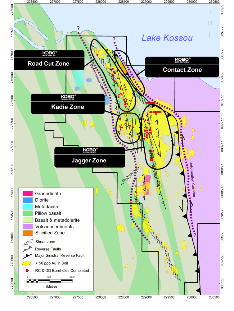
In 2023, a structural geological study led by Dr. Ghislain Tourigny revealed key insights about the Kossou Gold Project. Gold mineralization is concentrated within a well-defined fault corridor over 3 kilometers long and +300 meters wide, with gold-bearing lenses found in areas of intense shear strain and hydrothermal alteration. The Contact Zone Fault appears to be a major crustal break that likely facilitated the flow of gold-bearing fluids. Additionally, high-angle quartz-carbonate veins that cross-cut the dominant north-south shear zones have the potential for very high-grade gold values.
Drilling
In Q3 2023 the Company completed a 5,887, 53 hole Reverse Circulation (“RC”) drilling program on the Jagger Zone and Road Cut Zone. See each Zone for details of the program.
In H1 2024 the Company completed a 4,368 m, 25 holes Diamond Drilling (“DD”) program that included the Jagger, Road Cut and Kadie zones (see Zones for details). The 2023 Reverse Circulation (RC) drilling program has produced several significant intersections, including 6.0 m at 3.54 g/t Au in the Jagger Zone and 5.0 m at 4.85 g/t Au in the Road Cut Zone. These results highlight the continued success of Kobo's drill program.
In H1 2024 the Company completed a 4,348 m, 26 hole program that followed up on the strong results of the inaugural 2023 RC drill program at both the Road Cut and Jagger zones and zones. The program also tested the Kadie Zone with five drill holes. The highlight results at the Kadie Zone was 9.0 m at 23.99 g/t Au.
Based on strong results at the three main targets, the Company has launched a 10,000-meter diamond drill program in September 2024 to accelerate exploration.
Location: Bongouannou Region
Stage: Early Exploration
Mineral: Gold
Ownership: 100%
Land Package: 302 km2
Status: Exploration
Infrastructure: Well established road network with local towns and villages
The Kotobi Gold Project is located in the Central-East region of Côte d'Ivoire, within the triangle formed by the departments of Arrah, Bongouanou, and Daoukro, specifically in the Moronou region, with Bongouanou as the regional capital. Access to the permit area is facilitated by paved roads from Abidjan to Bongouanou.
Geology
The property is located within the Birimian Dimbokro-Abengourou Belt of the Boaulé-Mossi Domain with the West African Craton, comprised of Birimian aged volcano-sediments, schists and conglomerates emplaced along a north-northeast trend.
Locally the property consists primarily of Birimian aged metaarentite and metasiltstone lithologies with lesser granitoid intrusives mapped to the southwest and northeast.
Regional scale government mapping suggests a strong NE-SW, west dipping fabric to the region.
Significant recent artisanal mining has been observed in the northern portions of the project area and in numerous locations within the central and southern portions of the project as well.
Soil Geochemistry
In 2020 the Company undertook a preliminary gold in soil sampling program as a first step in greenfields exploration. In total, 2,644 soil samples were collected on 400 m survey lines with stations every 100 meters.
Results indicated several anomalous zones that require follow up detailed soil sampling and mapping.
Geophysics
In 2023 the Company completed a UAV magnetic survey covering the whole of the property. A total of 1,565 line-kilometers data was acquired along NW-SE flight lines at approximately 200 m spacing with a drone height of approximately 90 meters.
The Company recently completed processing of the data and developed several targets on the concession that will require follow up work.
Land package
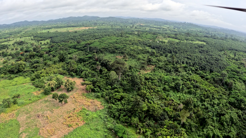
The Kotobi property covers a total area of 302 km2 and is located approximately 135 km due east of Yamoussoukro and 165 km due north of Abidjan. The topography of the region is relatively flat and is covered by lush vegetation.
Infrastructure
The area can be accessed by a good network of paved and dirt roads and there are a number of small to moderate sized communities that provide work force, supplies and accomodation for crews.
Permits
Active research permits
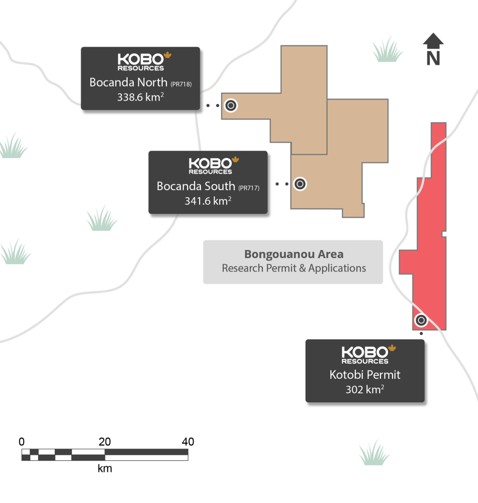
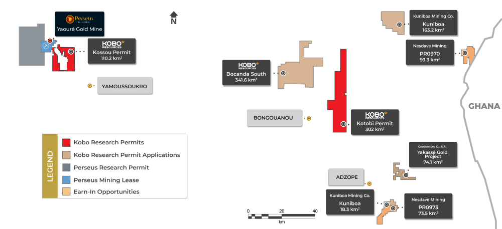
Kossou permit - 110.2 KM2
Kotobi permit - 302 KM2
Pending research permit applications
Bocanda South permit - 302 KM2
Kuniboa permiti - 163.2 KM2
Kuniboa permiti - 18.3 KM2
Yakassé Gold Project - 74.06 KM2
Nesdave Mining earn-in opportunities
PR0970ii - 93.3 KM2
PR0973ii - 73.5 KM2
i. Kobo has established KUNIBOA MINING Co. (“Kuniboa”) with local partners, holding a 40% stake as its largest shareholder. Through Kuniboa, the Company has applied for two additional exploration licenses totaling 181.59 km².
ii. Kobo has entered into two earn-in agreements with NESDAVE MINING SARL (“Nesdave”), a local Ivorian exploration company based in Abidjan, Côte d’Ivoire. See press release dated March 3, 2025.iii. Kobo has entered into an earn-in agreement with GEOSERVICES CI SA (“Geoservices”), a local Ivorian exploration company based in Abidjan, Côte d’Ivoire. See press release dated July 31, 2025.
Quality Assurance and Quality Control Compliance
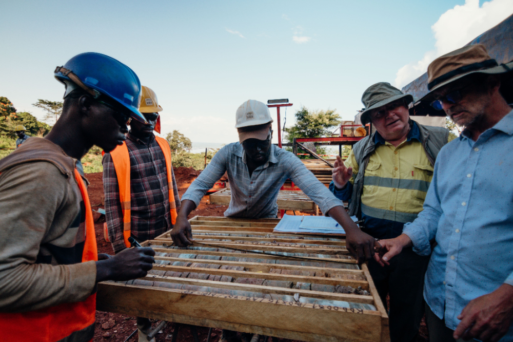
Rock Sample and Trench Sample Analytical Procedures
All rock samples collected between 2020 and 2022, with the exception of samples 006801 to 007463 and 006706 to 006736, were analysed at ALS Laboratories in Yamoussoukro. The samples were prepared using ‘’PREP-31B’’ (Crush to 70% less than 2mm, riffle split off 1kg, pulverise split to more than 85% passing 75 microns). After which samples were analysed for gold using ‘’Au-AA26’’ (by fire assay and AAS 30g sample) and for multi-element assay using ‘’ME-ICP61’’.
All samples analysed at the SGS facility in Yamoussoukro using a 50 g Fire Assay with an AA finish (FAA505 with prep code PRP87). Samples assaying greater that 5.0 g/t Au were re-submitted for Fire Assay with Gravimetric finish (FAG505). Those values were considered final. QAQC procedures for the drill program include the ion of a certified standard (CRM) every 20 samples, a blank every 20 samples and a duplicate sample (split of the original sample) every 20 samples. All QAQC control samples returned values within acceptable limits. SGS is 17025 accredited and is completely independent from Kobo.
RC Drilling Sampling Analytical Procedures
One meter composite samples of RC chips were sent to the MSA Labs facility in Yamoussoukro where the entire sample was dried and split into 500 g subsample for analysis (prep code CRU-CPA). Sample splits were then analysed for gold using PhotonAssayTM (CPA-Au1). QAQC procedures for the drill program include ion of a certificated standards (CRM) every 20 samples, a blank every 20 samples and a duplicate sample (split of the 1 m original sample) every 20 samples. All QAQC control samples returned values within acceptable limits. MSALabs are ISO 17025 and ISO 9001 certified and are completely independent from Kobo.
Diamond Drill Sampling Analytical Procedures
Drill core was logged and sampled by Kobo personnel at site. Drill cores were sawn in half, with one half remaining in the core box and the other half secured into new plastic sample bags with sample number tickets. Samples are transported to the SGS Côte d’Ivoire facility in Yamoussoukro by Kobo personnel where the entire sample was prepared for analysis (prep code PRP86/PRP94). Sample splits of 50 grams were then analysed for gold using 50g Fire Assay as per SGS Geochem Method FAA505. QAQC procedures for the diammond drill program include ion of a certificated standards (CRM) every 20 samples, a blank every 20 samples and a duplicate sample (split of the 1 m original sample) every 20 samples. All QAQC control samples returned values within acceptable limits. SGS is 17025 accredited and is completely independent from Kobo.
Review of Technical Information
The scientific and technical information on this website has been reviewed and approved by Paul Sarjeant, P.Geo., who is a Qualified Persons as defined in National Instrument 43-101. Mr. Sarjeant is the President and Chief Operating Officer and Director of Kobo.